Finding Gold in the Cariboo Mountains – A Photo Journey
Words by Dalene Heck | Photography by Pete Heck
Two substantial gold rushes defined British Columbia in the mid-1800s. The more famous of the two, the Cariboo Gold Rush, graced some of the mountains and valleys in the photos below. It brought prospectors from around the globe, elevated the economy of every stop en route, and forever transformed a substantial area. Gold is still mined in the Cariboo Mountains, albeit with less fervour and more advanced mechanical techniques, and the now-diminished population reflects that. Whole towns have been ghosted.
But the draw of exploration remains. In the mist and drizzle of our first few days in the area, starting in the tiny town of Likely and making our way north to Wells and the iconic Barkerville, we both wanted to grab a pan and sift river bottoms. We wanted to kick rocks to see if anything sparkled from underneath. Not for the chance of riches but to transport us to the time when the Cariboo Gold Rush caused the whole area to ripple with frenzy.
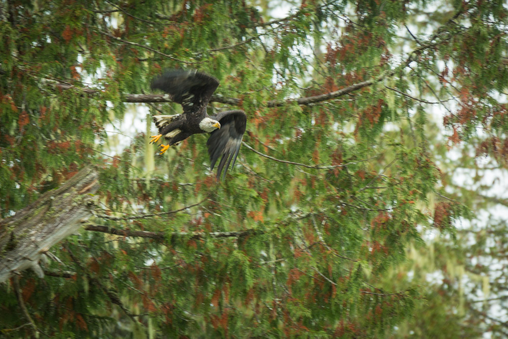
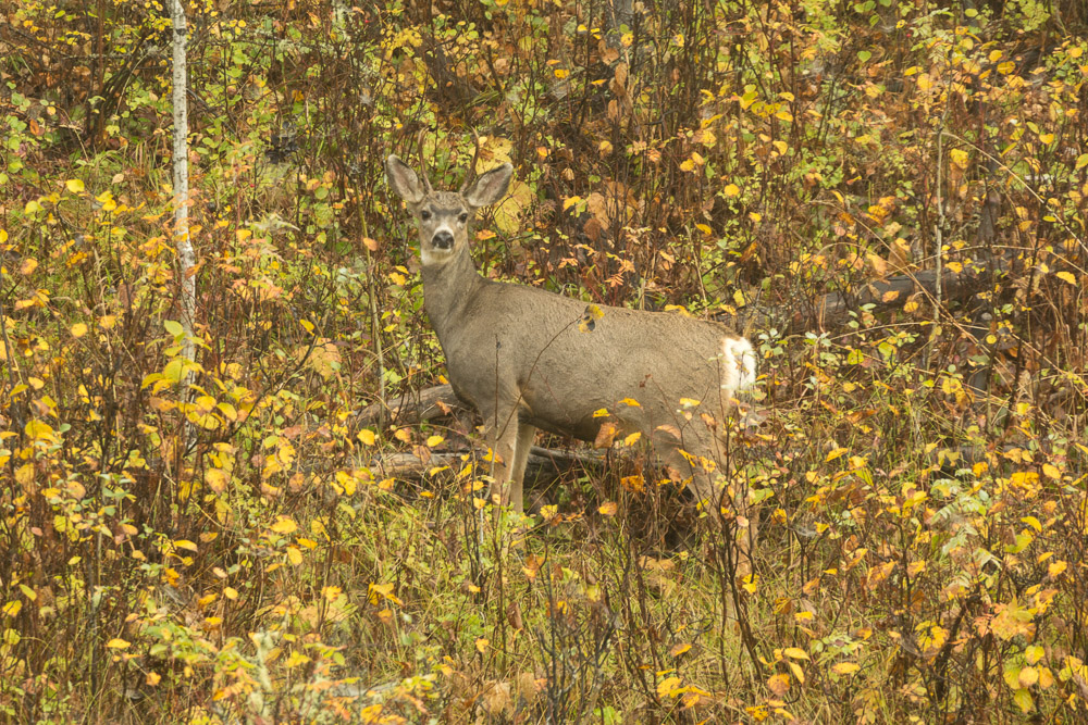
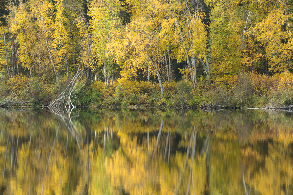
Our days there indeed included a search – not for a precious metal but with our cameras angled for autumn and animals. The former we were surrounded by, with golden leaves that glistened in ubiquitous dew. With the latter, our prospect for grizzlies came up empty. But the rear of a bolting black bear, a moose on a meadow, bald-headed eagles, and several deer held our attention instead.
Our journey was not left wanting for riches.
Exploring the Cariboo Mountains
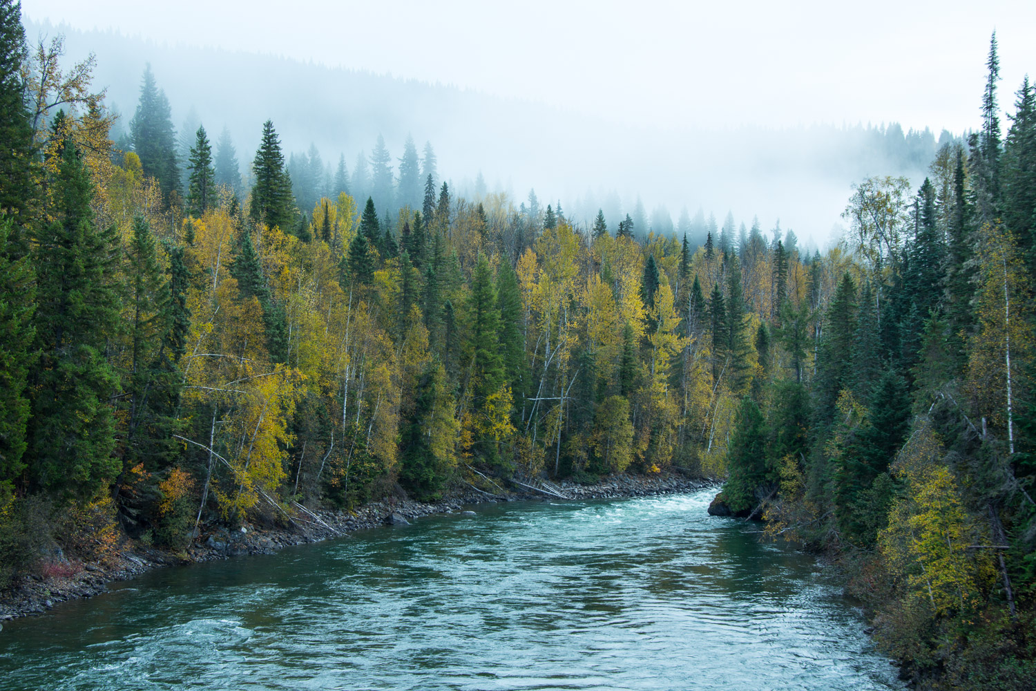
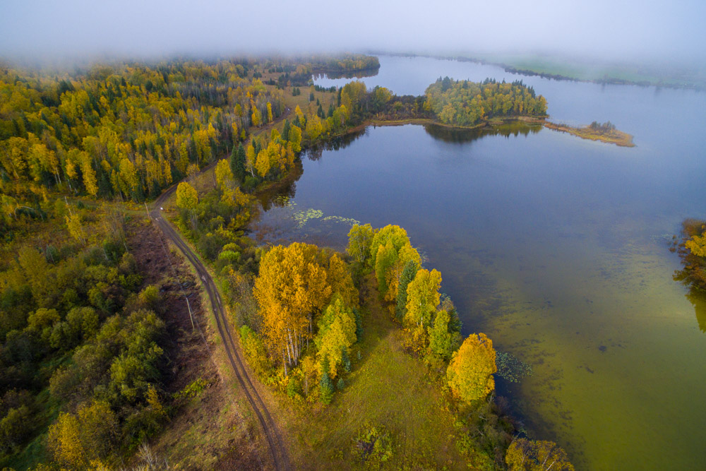
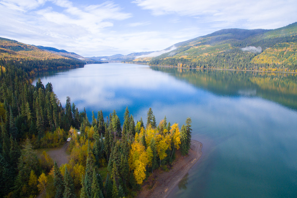
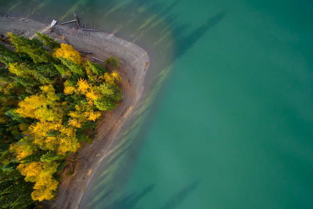
Likely, BC
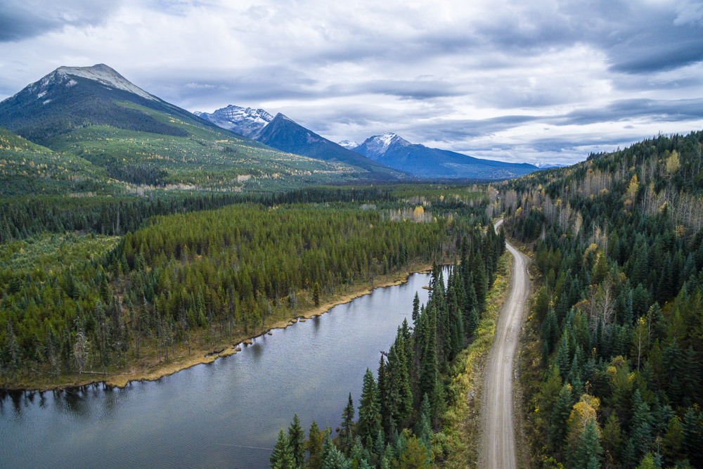
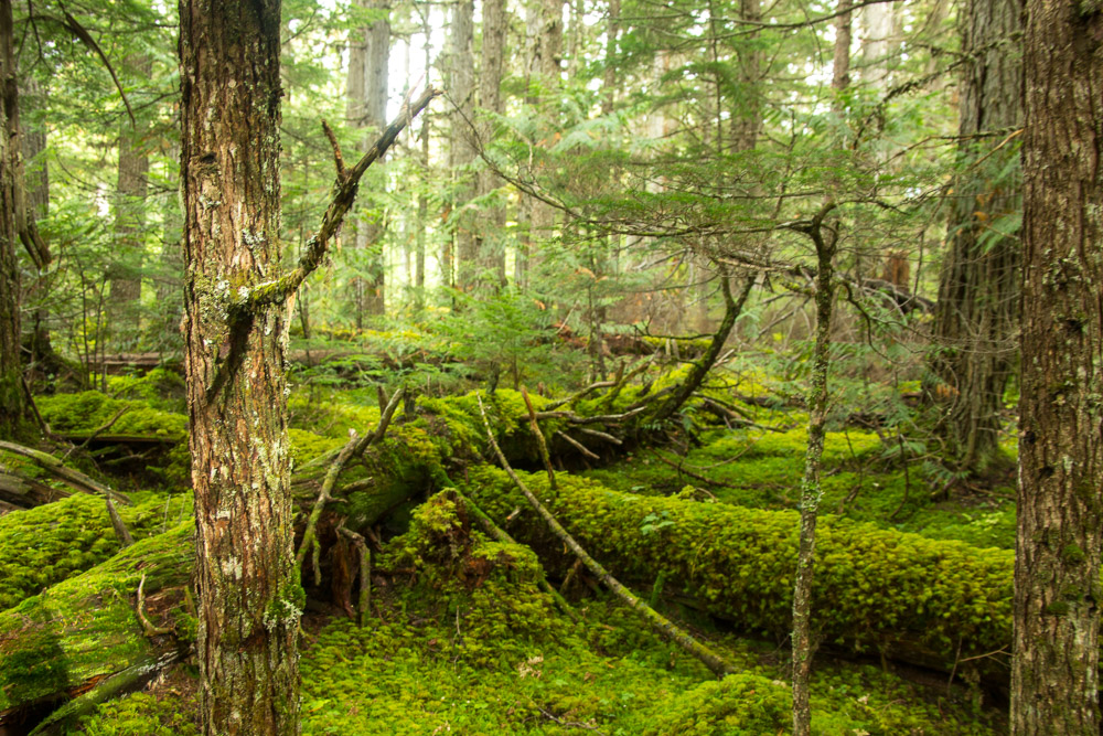
While the official Gold Rush Trail begins hundreds of kilometres south of Likely, our journey began in this little town on the Quesnel River. It is one of the few gold rush settlements that remains. There’s only one store and a handful of houses, but it holds a draw for fishermen and adventurers alike for the surrounding nature. Our day trips from here included an expedition up the nearby Mitchell River and jaunts down many of the quiet roads in the area.
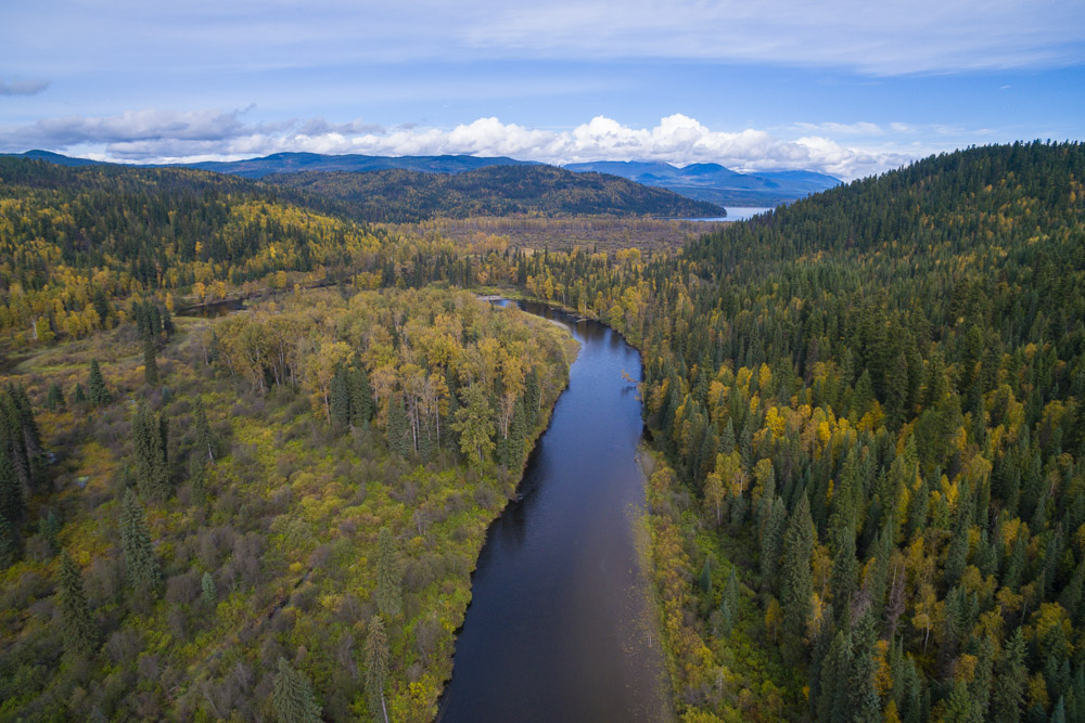
Making Our Way to Wells, BC
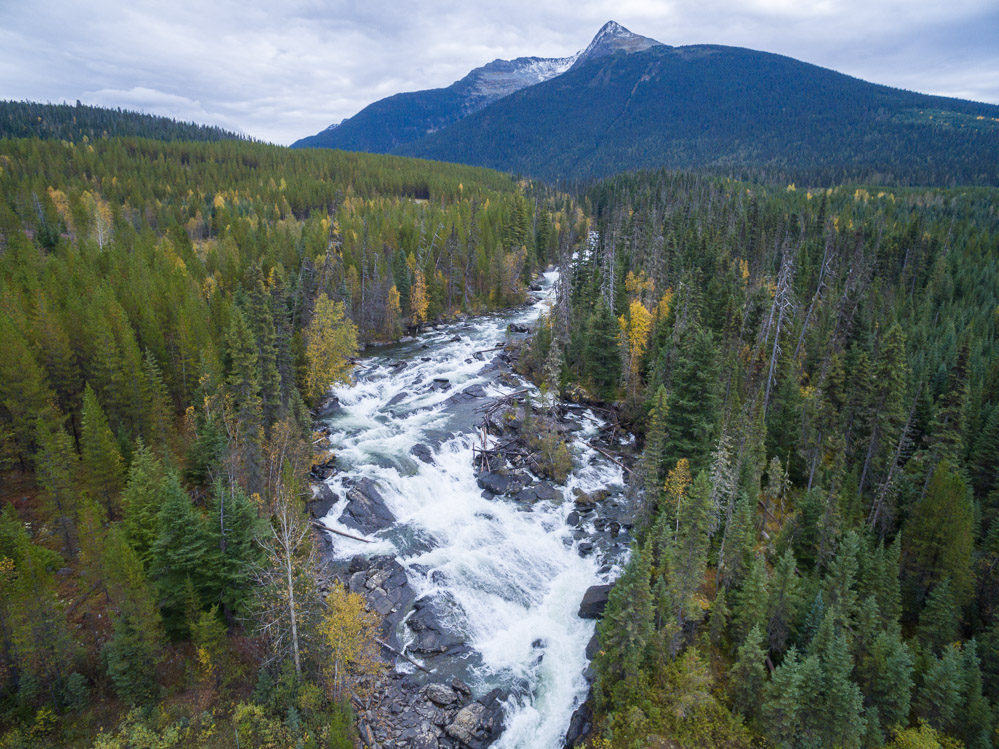
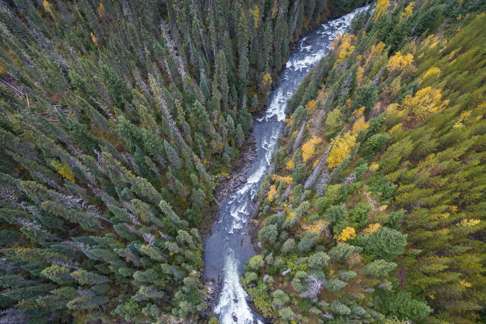
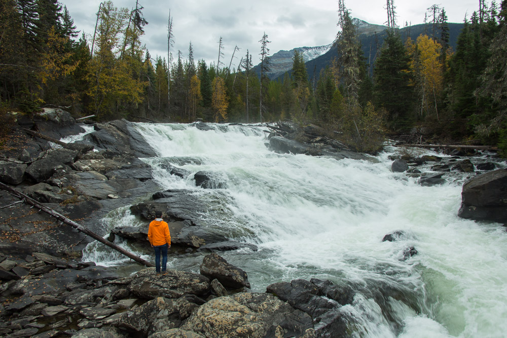
From Likely, we took the scenic route north and drove what is literally known as “the back road” to Wells. It is only a 150 km journey, but we made it last all day with an inestimable number of photo stops of the Cariboo Mountains and a lazy picnic lunch near waterfalls.
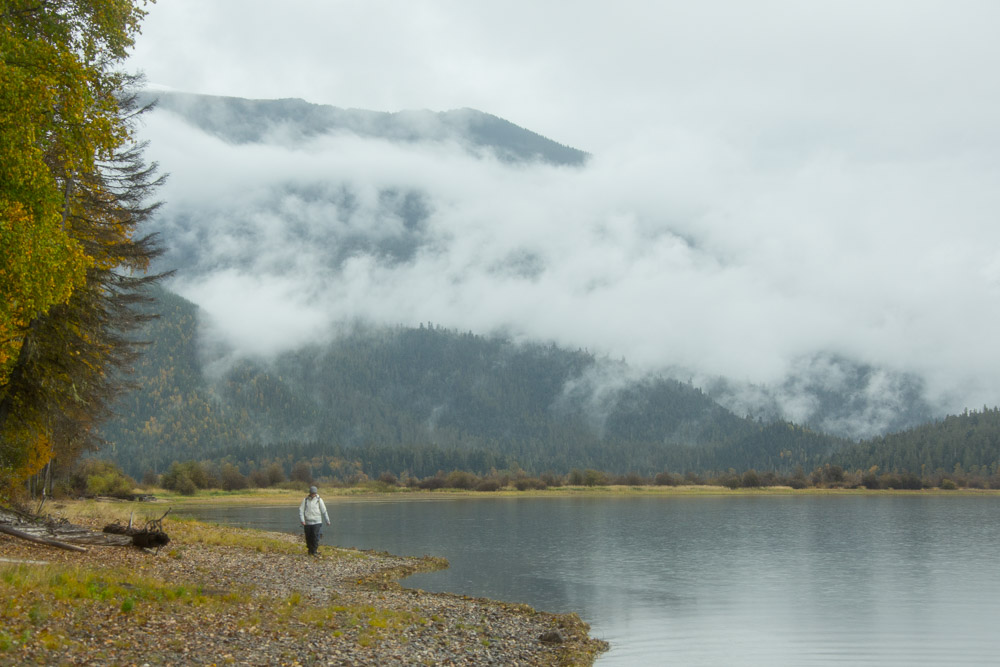
Visiting Wells, BC
On the edge of town, we were flagged down by a passerby. He gestured to the vast meadow that spread out from the road and opened with just one word: moose. There he was, a large bull just a couple hundred metres ahead. With a quick change of his camera lens, Pete was poised and began shooting. Within minutes, several others surrounded us as if they were gathered by some silent moose whistle that only townspeople could hear.
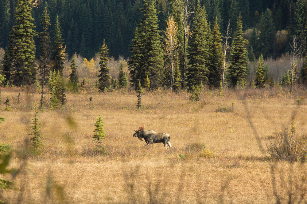
Their photography gear put ours to shame. For them, such a sighting was probably a regular occurrence, yet all were still determined to capture the scene. “It doesn’t get old,” one told us. Geoff, our guide, tested his moose calls to try and draw the bull closer. “It’s a special place.”
The population of this picturesque town may be a fraction of what it once was as a mining hub, but it is not lacking in allure. It has a tiny but strong community of artists and adventurers alike. Bright buildings sit on the edge of this vast meadow that teems with life. In the wintertime, it is a focal point for cross-country skiers and sledders. In the summer, it’s the starting point for the popular canoe circuit at Bowron Lake Provincial Park.
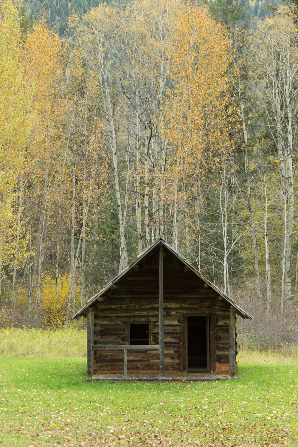
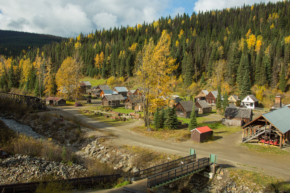
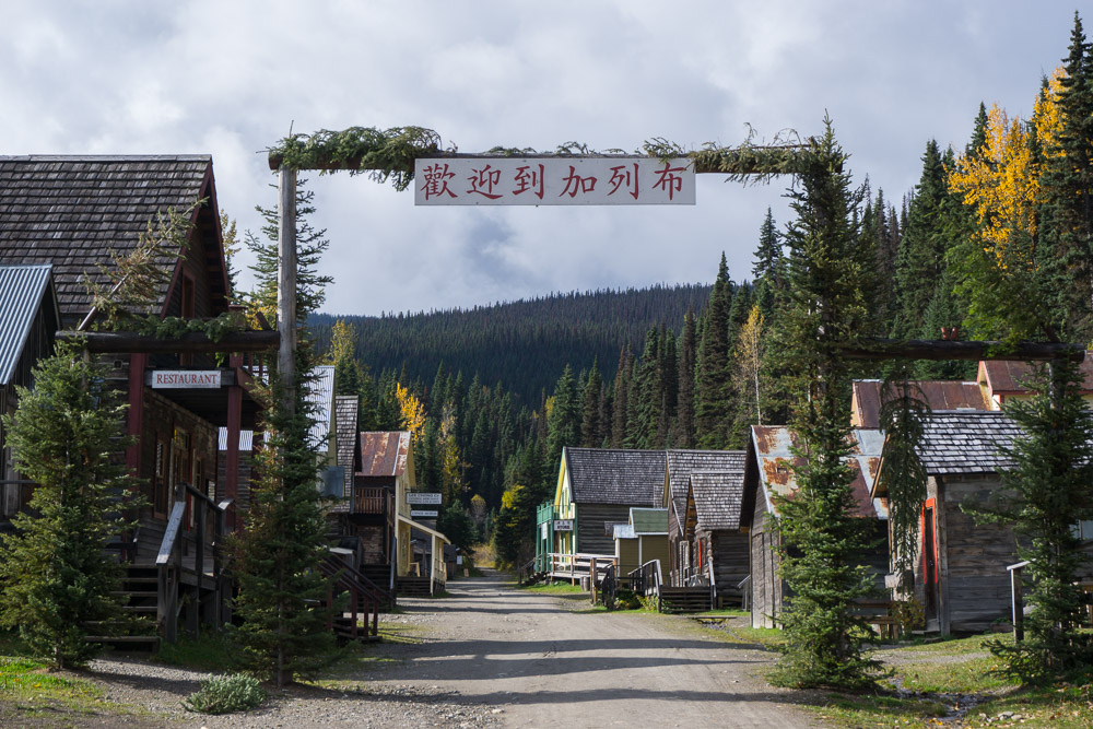
Barkerville, BC
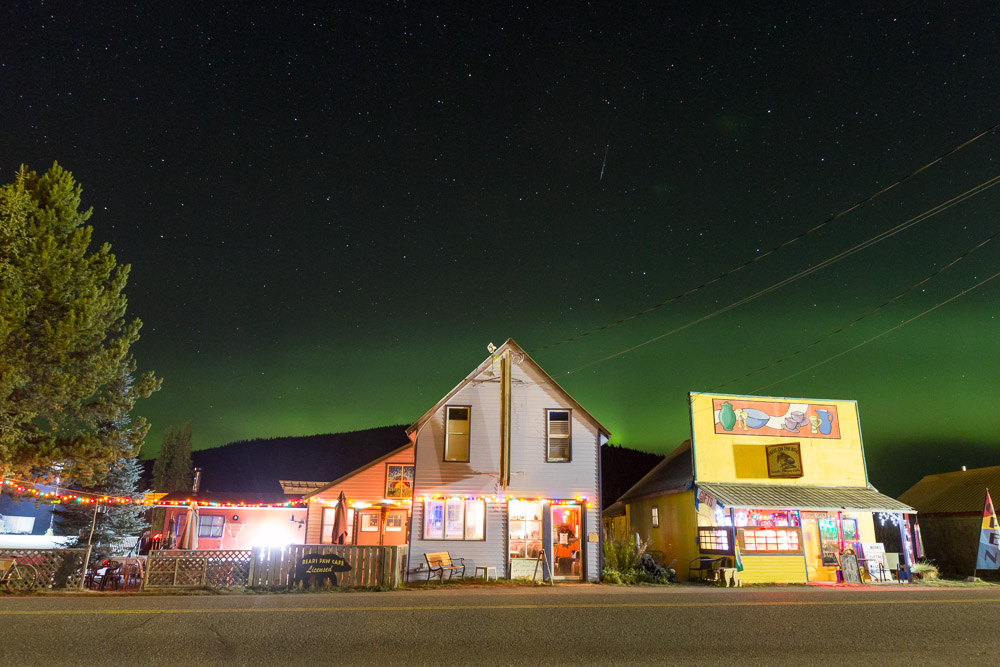
Near to Wells is Barkerville, a world-class heritage site named after an English prospector who spearheaded growth in the region that eventually shaped the entire province.
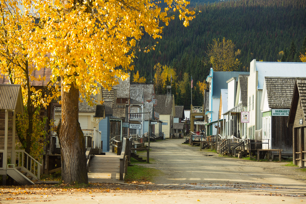
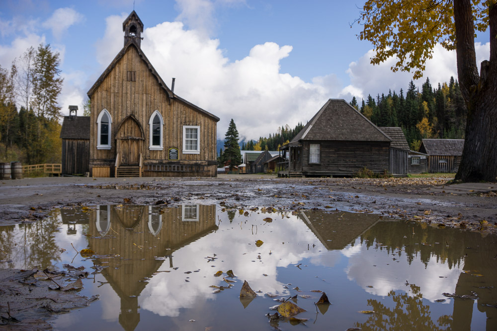
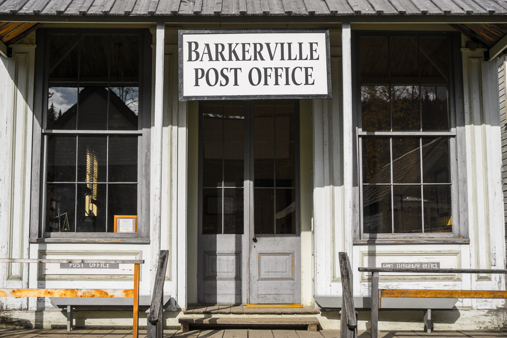
In the summer it bustles as a living museum, with visitors weaving in and out of the over 100 structures that stand in the same spot as when they were built starting in the 1860s, and interacting with the actors in character from that period. Winter activities are planned but less involved. We visited just after the summer season had closed and had the town entirely to ourselves.
That doesn’t mean, however, that to visit means an absence of treasure.
Hey guys, now that I am temporarily living in Edmonton for the summer and fall this is very tempting. I am wondering – do you think the back roads in the area would be okay with a small RV? Where did you stay when you were there? Camping?
Hi Susan! As long as there isn’t tough weather, I think you would be fine on the roads with a small RV! We didn’t camp while we were there, we stayed at a lodge in Likely and at the Mountain Thyme Getaway in Wells (the latter we would HIGHLY recommend – more on that in our next post).
WOW! This place is STUNNING! I have to get here some day. I love finding new places for my bucket list.
Beautiful pictures – as always. What is the story behind the Asian lettering on the sign in the last picture? If you told it, I missed it.
My apologies Vicky, I had meant to put something in the photo caption and forgot (will go and do that now). Barkerville attracted prospectors from all over the world, and from China in particular. By the 1880s, half of of the towns population was Chinese and this was their area of town. Here is a bit more info on the topic: http://www.cariboogoldrush.com/people/chin.htm
Thank you Dalene, that was my guess, but nice to have it confirmed. The fall colors there are lovely. Hope you are doing well.
Hi Dalene and Pete,
Happy to see you both back on the road. The photos are really good Pete. Looking forward to more of your journeys….be well…?
Molly Huddleston
I love old mountain mining towns, and BC! I feel like I say this on every post, but your photos just blow me away! Amazing.
Stunning pictures as always. Is it possible to buy the first picture? Very Canadian! I used to see pictures like this in coffee table books on Canada before it became home 🙂
Absolutely Gurdish! Fire us an email at info@hecktictravels.com
So good to see you back on the road! The place looks like one hidden gem, would absolutely love to explore it for myself one day.
Your photos of the area around the Quesnel River are stunning!